Our local conservation area, Burns, has a small lake and a 2 KM trail where I often walk our dogs since it's so close to our home. We've been visiting this conservation area for over 25 years and lived near it for 24 years. I avoided it this summer largely due to the mosquitoes (despite the fact that we had a drought, there were still plenty of mosquitoes). Now that it's turned cool(er), I ventured there with Miska, Tyro and Diva yesterday and was shocked to see what remains of the lake which might be better called a puddle or mudflats. The water level is down at least 5 feet, which in a small lake, makes a huge difference. I have pictures here going back 7 years and this is the lowest water level I ever recall seeing in 25+ years.
Burns Lake, October 6, 2012
 |
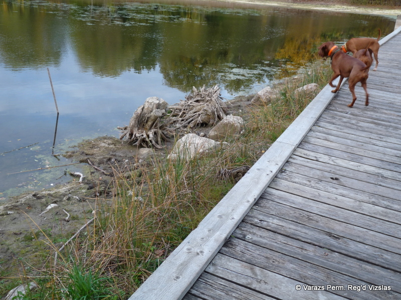
| No dock diving for the dogs!! The water is usually right up to the grassy area to the R of the boardwalk |
 |
| Dogs started barking at the tree stumps since they (dogs) aren't used to seeing them there |
 |
| Contrast this with the similar view (below) in 2008 |
 |
| Overflow channel; water in spring is usually up to the top of this structure |
 |
| Tree stumps now visible in the middle of the lake. |
 |
| View looking back at the dock area; all this mud is usually covered with water |
 |
| The 'mud flats' |
Burns Lake, May 2005
The water table is always higher in spring due to melting snow and spring rain although it wasn't as high in May as some years,
 |
| Sasha in Burns Lake, May 31, 2005 |
|
|
Burns Lake, October 2, 2008 (below)
These were taken 4 years ago, at almost the exact time of year as this fall. Notice how much water there is in the lake four years ago.
 |
| Diva & Miska |
 |
| Normal water levels in fall. |
Burns Lake, November 6, 2011 (below)
The lake was filled with water when we took the Varazs Vizsla family for a walk almost one year ago.


Wow, it's incredible how much the water has receded! Seriously, we do have to worry about our environment.
ReplyDelete